The Singapore Institute of Technology and the Land Transport Authority harnessed virtual reality to create better commutes. Called the ‘Virtual Reality Commuting Simulator (VRCS)’, this digital transport tool allows LTA to evaluate commuting experiences efficiently.

A demonstrator showcasing how the Virtual Reality Commuting Simulator (VRCS) works. (SIT Photo: Keng Photography/Tan Eng Keng)
Donning a pair of virtual reality (VR) headset with a set of black, palm-sized trackers attached to his torso and limbs, a participant purposefully walks on the spot, arms swinging with every step.
He may be going nowhere in the real world, but it is a scenic stroll in the virtual HDB estate being shown on his headset. A ‘commuter’ passes a coffee shop, fitness corner and badminton court, before ending up at the void deck of a HDB block. From the building’s bright splashes of yellow to the wooden sit-up benches, no detail has been spared.
This is the Virtual Reality Commuting Simulator (VRCS) – a digital transport tool that the Singapore Institute of Technology (SIT) has developed. Built to evaluate commuting experiences, this collaboration with the Land Transport Authority (LTA) can potentially eliminate the need for laborious surveys and interviews. The method is simple: in this simulation, every step means information.
Is a sheltered walkway required for this open area based on footfall? How many people are actually using this particular flight of stairs? The VRCS, with its 3D-constructed HDB estates modelled after real-life counterparts, can reveal these answers.
Harnessing this data, LTA can then build better first and last-mile connections for commuters. The ability to specifically see the exact paths that commuters take in the VRCS will help its transport planners strategise the best spots to build pedestrian infrastructure like footpaths and overhead bridges across Singapore.

“We’ve created this system that allows LTA to invite commuters into a lab setting and have them go through a simulated commuter experience,” said Associate Professor Tan Chek Tien (left), the Principal Investigator of this collaboration. “It allows them to do a deeper qualitative analysis of what the commuters are experiencing,” he remarked.
As Centre Director of SIT’s Centre for Immersification, he spearheaded the recently concluded applied research project which commenced in 2019. The VRCS is one of three tools that SIT has helped LTA develop as part of the research. Tapping on its strength of applied research, the university also created a commuter app that collects real-world data from users on their daily travels, along with a 3D-scanning software tool that can help create an interactive digital twin of the real world.
“LTA was happy with the experience,” said Associate Professor Jeannie Lee, Deputy Director of SIT’s Centre for Immersification, who co-led the project with A/Prof Tan. “We collated very good findings.”
Keeping It Real
While going digital offers convenience, turning an entire HDB estate virtual was immensely complex. Creating the original prototype of the VRCS first required A/Prof Tan and his team to survey an area spanning 2.5km2 – the size of 467 football fields.

Hours of scanning and programming resulted in the VRCS. (SIT Photo: Keng Photography/Tan Eng Keng)
It was a painstaking process that was both physical and technical, one that required plenty of walking and a sophisticated array of equipment ranging from drones to custom robotic scanners. “We had to use a handheld scanner to capture every pillar under the HDB blocks,” recalled A/Prof Tan. Scanning every inch of the estate took nearly an entire year.
Once all details had been collated, the next step was to turn the individual point clouds – a vast collection of datasets representing each scanned object – into a seamless 3D environment. This added another layer of complexity as it involved merging different scanned resolutions, data formats and illumination artefacts due to capturing at different times of the day.

Technology provided some much-needed assistance. “We had to use a machine learning algorithm to identify various objects in the 3D point clouds– whether it was a park bench or a tree,” explained A/Prof Lee (left). Once everything had been converted into 3D, the team pieced everything together like LEGO bricks to procedurally generate the digital twin.
Faced with the issue of limited space, they also had to devise a way for participants to take infinite steps in the VR world. The solution: walking in place with the help of trackers. Feedback from a published study with over 40 participants helped the team further refine their software, ultimately providing an experience that was both immersive and informative.
“Being realistic was key as it was meant to simulate real commuting,” explained A/Prof Lee.
Invaluable Industry Experience
As a university of applied learning, SIT’s work with partners like LTA has allowed its academic staff to be in touch with the latest industry trends and stay relevant in their research. Students get to benefit too as they are roped in to be part of the action.
For instance, the VRCS project saw over 40 students getting involved in all aspects, from carrying out scans on the ground to assisting in the programming of the mobile application. The team also ensured they adhered to standard industry guidelines and practices, bestowing them with the technical know-how that could be useful in their careers.

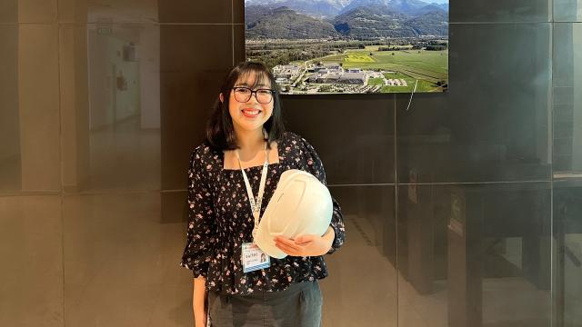
Megani Rajendran, a DigiPen Institute of Technology graduate in Computer Science in Real-Time Interactive Simulation, was part of the team of students contributing to the research. “The hands-on experience provided me with opportunities to hone my skills in programming and allowed me to work on real-world projects. The deadlines and expected deliverables taught me how to manage projects conscientiously and professionally,” she shared.
“The important thing is that we’re training them in industry-relevant skills and techniques in specific areas like 3D scanning and machine learning,” said A/Prof Lee. “This supplements their knowledge for future work applications too.”
Photos of A/Prof Tan, A/Prof Lee and Megani by Keng Photography/Tan Eng Keng.
![[FA] SIT One SITizen Alumni Initiative_Web banner_1244px x 688px.jpg](/sites/default/files/2024-12/%5BFA%5D%20%20SIT%20One%20SITizen%20Alumni%20Initiative_Web%20banner_1244px%20x%20688px.jpg)


